IMD Weather Update: The IMD has issued an alert for “heavy to very heavy rainfall” in isolated areas of Odisha, Jharkhand, Bihar, Chhattisgarh, and Sub-Himalayan West Bengal.
The India Meteorological Department (IMD) in its latest weather forecast has predicted moderate rainfall over East India, with scattered rain anticipated in Northeast India. Isolated heavy rainfall is likely in Uttarakhand on September 17, East Uttar Pradesh between September 15-18, and West Uttar Pradesh on September 17 and 18. Chhattisgarh and East Madhya Pradesh are likely to witness isolated very heavy rainfall from today.
The IMD has issued an alert for “heavy to very heavy rainfall” in isolated areas of Odisha, Jharkhand, Bihar, Chhattisgarh, and Sub-Himalayan West Bengal. Coastal Karnataka, Kerala & Mahe, and Lakshadweep can expect scattered to widespread light to moderate rain, while other regions will see isolated to scattered rainfall throughout the week. The northeastern region, including Nagaland, Manipur, Mizoram, Tripura, Assam, and Meghalaya, will also experience heavy showers throughout this week.
Read More: How Pacific Cyclone Yagi might bring another wet spell for Delhi next week
Deep depression over Gangetic West Bengal
IMD on Sunday reported that a deep depression over Gangetic West Bengal and neighboring Bangladesh has been moving west-northwest at 5 km/h over the past six hours. The system is expected to remain a deep depression until September 15 before gradually weakening into a depression. Following this development, South 24 Parganas experienced rainfall, with heavy rain visibly affecting the Sundarbans region.
“The deep depression over Gangetic West Bengal moved west-northwestward at a speed of 5 km/h over the past six hours and was centred at 1200 UTC today, September 15, 2024, over the same region near latitude 22.8degN and longitude 87.2degE, approximately 120 km west-northwest of Kolkata, 70 km south of Bankura, 100 km east of Jamshedpur, and 200 km east-southeast of Ranchi,” the IMD stated.
“It is likely to continue moving slowly, nearly westwards, across Gangetic West Bengal, maintaining its intensity as a deep depression until September 15. Thereafter, it is expected to gradually weaken into a depression and move westwards across Jharkhand and northern Chhattisgarh over the next 48 hours,” the IMD added.
Read More: Why Arvind Kejriwal Wants 2 Days To Resign From CM Post? Atishi Reveals Reason
Delhi weather forecast
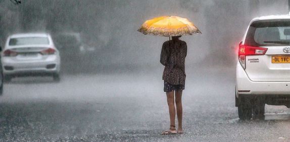
Delhiites woke up to a pleasant morning today with the temperature settling at 24°C. According to the regional meteorological center, New Delhi, light rain and thunderstorms is likely in the national capital today. The day’s forecast indicates a minimum and maximum temperature of 24°C and 35°C, respectively. The relative humidity is 39% and the wind speed is 39 km/h.
Met issues ‘yellow’ alert for Himachal
The local meteorological center issued a ‘yellow’ alert for thunderstorms and lightning in isolated areas across six districts of the state. The weather office also forecasted a continued wet spell in the state until September 21. Intermittent rains have been affecting various parts of the state, with Kasauli receiving the highest rainfall of 53 mm since Saturday evening.
During this period, Dharampur recorded 26 mm of rain, Renuka saw 20 mm, Chamba received 11 mm, Karsog had 10 mm, Kalpa experienced 8.5 mm, Nahan recorded 7.9 mm, Sarahan received 6 mm, and Dharamshala and Kangra each saw 5.8 mm. In terms of temperatures, Kukumseri in Lahaul and Spiti was the coldest, with a low of 7.8 degrees Celsius, while Una recorded the highest maximum temperature at 33.8 degrees Celsius.
Heavy rainfall in Uttar Pradesh
The meteorological department has forecasted heavy rain at isolated locations in eastern Uttar Pradesh and “thunderstorms with lightning” in scattered areas over East Uttar Pradesh. According to the Relief Commissioner’s report, the river Ganga is currently flowing above the danger mark at Kachhla Bridge in Budaun, while the Yamuna is elevated in Auraiya, Kalpi, Jalaun, and Hamirpur. The Sharda River is above the danger level in Palliakalan and Sharda Nagar (Lakhimpur Kheri), and the Ghaghra River is high at Elgin Bridge (Barabanki) and Ayodhya.