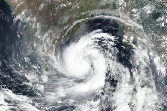
Cyclone Mandoud would continue to move west-northwestwards and cross north Tamil Nadu, Puducherry and adjoining south Andhra Pradesh coasts between Puducherry and Sriharikota, around Mahabalipuram
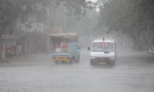
New Delhi: As the `Mandous Cyclone` is likely to become severe and gather more intensity by Friday (December 9, 2022) morning, IMD has issued a red alert for three districts of Tamil Nadu that are Chengalpattu, Villupuram and Kancheepuram. The IMD also stated that “due to cyclone Mandous, there will be light to moderate rainfall at most places, heavy to very heavy rainfall at few places, and extremely heavy rainfalls at isolated places likely over north coastal Tamil Nadu and Puducherry, and isolated heavy to very heavy rainfall likely over adjoining north interior Tamil Nadu, today.”
The Greater Chennai Corporation issued precautionary measures and ordered to close of all parks and playgrounds till further notice. The Greater Chennai Corporation Commissioner met with officials to discuss precautionary measures to be taken in light of the Mandous Cyclone. Chennai Corporation has also asked residents not to visit beaches tomorrow and to park their cars in open areas rather than under trees. Meanwhile, due to Cyclone Mandous, all schools and colleges in Puducherry and Karaikal will be closed on Friday, according to Education Minister A Namassivayam.
India Meteorological Department (IMD) on Friday morning predicted that the severe cyclonic storm Mandous will move west-northwest and cross north Tamil Nadu, Puducherry and adjoining south Andhra Pradesh coast between Puducherry and Sriharikota with a windspeed of 65-75 kmph around midnight of December 9. “The severe cyclonic storm Mandous over the Southwest Bay of Bengal about 270km East-southeast of Karaikal. To move WNW and cross north Tamil Nadu, Puducherry and adjoining south AP coast between Puducherry and Sriharikota with a windspeed of 65-75 kmph around midnight of December 9,” IMD said in a tweet at 2:59 am on Friday.
Earlier, IMD had predicted that the `Mandous Cyclone` is likely to become severe and gather more intensity by Friday morning.”It is likely to maintain its intensity of Severe Cyclonic Storms till the early morning of 9th December and then weaken gradually into a cyclonic storm by the forenoon of 9th December. It would continue to move west-northwestwards and cross north Tamil Nadu, Puducherry and adjoining south Andhra Pradesh coasts between Puducherry and Sriharikota, around Mahabalipuram as a cyclonic storm with a maximum sustained wind speed of 65-75 kmph gusting to 85 kmph around midnight of 09th December,” read an official statement by the IMD.
Meanwhile, all shops on the beach were closed due to the cyclone alert while fishing boats were moored far off the beaches for safety. Ambulances have been also deployed on the beachfront for emergency response.”The cyclonic storm “Mandous” pronounced as “Man-Dous” over Southwest Bay of Bengal moved nearly west-northwestwards with a speed of 13 kmph during the past 6 hours, intensified into a Severe Cyclonic storm and lay centred at 1730 hours IST of Thursday, the 08th December 2022 over Southwest Bay of Bengal near latitude 10.1°N and longitude 82.9°E, about 250 km northeast of Trincomalee (Sri Lanka), 320 km east-northeast of Jaffna (Sri Lanka), 350 km east-southeast of Karaikal and about 440 km southeast of Chennai,” said the IMD.
The Eastern Region Indian Coast Guard initiated pre-emptive measures, amid the cyclone threat.”The state administration has been requested to sensitise the coastal populace and State Disaster Management Authorities have been requested to issue advisories through local print, television and electronic media,” an official said. The cyclonic storm is situated approximately 420 km east-southeast of Karaikal and 520 km southeast of Chennai. A red alert has been issued for 13 districts in Tamil Nadu for Friday, while six National Disaster Response Force (NDRF) teams have been stationed.
(With agencies inputs)


