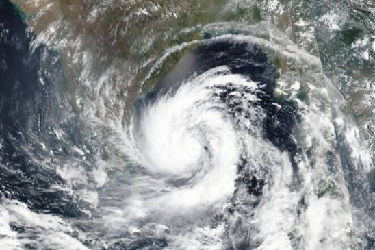
The low-pressure area formed over the south Andaman Sea is very likely to intensify into a cyclonic storm and reach the southwest Bay of Bengal near northern Tamil Nadu, Puducherry and adjoining south Andhra Pradesh coast by December 8 morning.
Under the influence of the cyclonic circulation over the south Andaman Sea and the adjoining equatorial Indian ocean-Strait of Malacca, a low-pressure area formed over the south Andaman Sea at 5.30 am on Monday.
Associated cyclonic circulation extends up to mid-tropospheric levels. It is likely to move west-northwestwards and concentrate into a depression over the Southeast Bay of Bengal by December 6 evening.
The Indian Meteorological Department (IMD) on Sunday said a low-pressure area is likely to form over the southeast Bay of Bengal and the adjoining South Andaman Sea on December 5. The low-pressure system might move west-northwestwards and concentrate into a depression over the Southeast Bay of Bengal by the morning of December 7.
The weather system may cause rainfall activity in seven districts of Tamil Nadu, Puducherry, Karaikal and the south coast of Andhra Pradesh starting on the night of December 7 and is likely to intensify the next day. Widespread light to moderate rainfall is also likely over Andaman and Nicobar islands from December 4 to 6.
The IMD asked fishermen to avoid the Bay of Bengal and Andaman sea for the next few days till December 8. Other areas to avoid include the coasts of Tamil Nadu, Puducherry, south Andhra Pradesh coast and the Gulf of Mannar from December 7 to 9.


