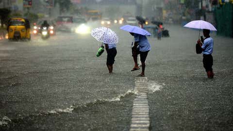
According to the India Meteorological Department (IMD) data, with a spell of rain unlikely on Wednesday, August is set to end with the lowest rainfall recorded in Delhi in at least 14 years. The Met officials said that though the national capital will see cloudy skies over the next five to six days, a good spell of rain is unlikely.
New Delhi: According to the India Meteorological Department (IMD) data, with a spell of rain unlikely on Wednesday, August is set to end with the lowest rainfall recorded in Delhi in at least 14 years. The Met officials said that though the national capital will see cloudy skies over the next five to six days, a good spell of rain is unlikely.
Weather experts attribute the lack of rainfall this month to the development of three
low-pressure areas over the northwest Bay of Bengal which pulled the monsoon trough over central India and did not let it move to the north for a long period.
Meanwhile, Delhi’s primary weather station, the Safdarjung Observatory, recorded a minimum temperature of 25.9 degrees Celsius. The maximum temperature is likely to settle around 35 degrees Celsius in the national capital.
On the other hand, the weather department said the monsoon activity over northwest India will remain subdued for the next five days. As per the IMD data, the Safdarjung Observatory has recorded a paltry 41.6 mm of rainfall against a normal of 233.1 mm so far this month.
Normally, the city gauges 247 mm of precipitation in August, the wettest month of the year.
According to data available on the IMD website, the capital recorded 214.5 mm of rainfall in August last year, 237 mm in 2020, and 119.6 mm in 2019.
“Three low-pressure areas (LPAs) developed over the northwest Bay of Bengal in August which travelled across Odisha, Chhattisgarh, Madhya Pradesh, Rajasthan, and south Pakistan, giving good rains there.
“The LPAs kept the monsoon trough south of its normal position for a long time. Delhi and other parts of northwest India received rain only when the trough passed over the region while moving to the foothills of the Himalayas,” said Mahesh Palawat, vice president (climate change and meteorology), Skymet Weather.
Usually, the trough is seen running through Sri Ganganagar, Delhi, Allahabad, Jharsuguda, Kolkata, and North Bay of Bengal.
The weather bureau had predicted normal to above normal rainfall in August over northwest India.
Overall, the Safdarjung Observatory has logged 350.8 mm of rainfall against a normal of 506.7 mm since June 1 when the monsoon season usually starts clocking a deficit of 31 per cent.
The deficit is likely to persist with subdued rains predicted for September.
A bountiful monsoon had yielded 1,169.4 mm of rainfall last year, the third highest since 1901.


