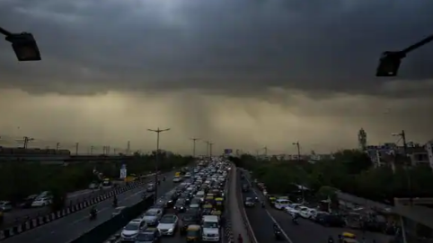
The monsoon hit a long lull after June 12, and began its advance only after June 20. It is yet to advance over northwest India, where the rainfall deficit has reached 57% this month
The sluggish pace of the monsoon has hit India’s rainfall deficit, which has dropped 19 percent below the long-period average this June. The monthly rainfall has been below-normal in 21 out of a total of 36 subdivisions after the monsoon hit a long lull after June 12.
The India Meteorological Department (IMD), which had earlier predicted normal rains for India during this month, had to revise its initial forecast on June 18 and downgraded it to ‘below normal’ for the country at less than 92 percent below the long-period average (LPA).
Read More: Labour Organisations Demand Increased Pay Under MGNREGA Scheme

Director general of meteorology, Dr Mrutyunjay Mohapatra said the MeT continuously updates the forecast as the weather conditions evolve. “The spatial distribution of rainfall can vary. We had forecast heavy rains over southern peninsula and northeastern states in June, and somewhat below-normal over northwest India. But as the monsoon progressed, we realised that the Bay of Bengal current was slightly weaker, which affected its progress over eastern states. So, we revised the forecast as early as possible. This can happen when some weather systems do not develop to strengthen the monsoon,” he said on Tuesday.
STAGGERING DEFICIT OVER NORTHWEST INDIA
India’s current rainfall deficit stands at 19 percent below the LPA as on June 25. The shortfall is highest at nearly -57% over northwest India, which was hit by prolonged heatwaves this June as temperatures crossed 47 degrees Celsius.
It stood at -16% over eastern and northeast India and -23% over central India. The rains have so far been in excess only over the southern peninsula, where it is currently 9% above the LPA.
While the initial forecast of above-normal rains over the southern peninsula was realised, it fell short over northwest India and adjoining areas of central India. “We expected the rainfall to be below-normal over northwest India, but it ended up much less than that. There was some delay in the progress of the monsoon from the eastern side. So, parts of Uttar Pradesh, Bihar, Chhattisgarh did not get covered on time. The easterlies (winds) did not get established well, which weakened the current,” said senior IMD scientist Dr DS Pai.
In its initial forecast for June, the IMD had predicted normal rains for India at 92 to 108 percent of the LPA. Region-wise, it expected above-normal rains over southern peninsula and adjoining areas of central India as well as over isolated areas of northwest and northeast India. It also expected below-normal rainfall over many areas of northern and eastern parts of northwest India and eastern part of central India.
IMD CONFIDENT OF GOOD RAINS IN JULY
The weather department, however, remains confident of its forecast of an above-normal monsoon from June to September. “The monsoon is looking much more organised now. The rainfall activity has improved significantly, so it should progress well now,” Pai said.
The latest forecast suggests monsoon could advance into most northern states from Jammu and Kashmir to Uttarakhand, as well as Punjab and Haryana during the next three to four days.
Accounting for nearly 70 percent of the annual rains over the country, the southwest monsoon is a crucial weather system for India. Its onset and eventual advance is keenly tracked by scientists because of its far-reaching effects not only on livelihood, but on the overall economy.
In 2021, the IMD revised the onset dates over different states due to the evolving climate conditions. “The normal onset dates were announced based on the data from 1961 to 2020, but the monsoon advance can vary each year. Sometimes, it can get a push from the Bay of Bengal while in other cases, it could be the Arabian Sea. But, this year, we expect good rains over the next three months,” Pai added.